
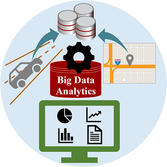
Abstract
More than half of fatal traffic crashes occur due to aggressive driving according to AAA (American Automobile Association) Foundation for Traffic Safety. Ubiquitous technology has made it possible to monitor driver behavior at a high frequency for a long period of time. This provides an opportunity for researchers to investigate risky driving behavior at a large scale. This project aims to develop a big data analytics framework and visualization tool to conduct spatiotemporal modeling and classify and visualize aggressive driving behavior using data from emerging technology. As an essential safety planning tool in the era of big data, this framework/tool can be used to identify where and when aggressive driving occurs. The Safety Pilot Model Deployment (SPMD) data, one of large transportation datasets available via the FHWA Research Data Exchange (RDE) program will be used as a big data example. A classification model will be developed to discriminate aggressive driving from normal driving using kinetic and environmental GIS data. Web-based data visualization tools will also be developed to identify the spatial and temporal distribution of aggressive driving. Furthermore, data visualization in a simulated real-time scenario will be conducted to produce insights from future transportation data considering the anticipated widespread adoption of autonomous and connected vehicle technology.
Project Highlights
- Utilizing unsupervised and supervised learning methods as well as open-source visualization development tools, risky driving moments were identified and visualized in a large, real-world driving dataset, where there is no hard evidence to confirm such moments.
- As part of classifying risky driving behavior, principal component analysis (PCA) was used to reduce the data dimensions. PCA can thus contribute to data size reduction, an effective technique when dealing with big data.
- Data points were converted into short monitoring period data, and risky driving was assessed in these monitoring periods. This not only provided additional information in terms of better identifying distinct driving behaviors but it also significantly reduced data size.
- Several software packages for data analysis and visualization were evaluated. Current desktop and Web GIS software were not able to handle very large data effectively (>1 GB). Most GIS software was found to have a capacity of 20–50 MB (150–270 K records), which is considerably small. Tableau was determined to be one of the best data visualization tools.
- Web-based tools were developed to visualize where and when risky driving occurred as follows: https://charles-marks.shinyapps.io/AggressiveMapper/
Final Report
EWD & T2 Products
Course Slides GEOG 594 (pptx): The project contributed to Big Data Science and Analytics Platforms (GEOG-594), taught by Dr. Dr. Ming-Hsiang Tsou during Fall 2018 and again in Fall 2019. The Safe-D project was introduced in the week 2 lecture (What is Big Data?). A dataset from this project is listed as one potential group project topic. One student used the GPS dataset and ArcGIS Insights for a technical demo.
Course Slides – GEOG 580 (pptx): The project contributed to Data Management for GIS (GEOG-580), taught by Dr. Atsushi Nara during Fall 2018 and again in Spring 2020. The Safe-D project and its database design using the E-R (Entity-Relationship) diagram were introduced.
Classification Model Demo: Project developed a ‘classification model that distinguishes aggressive driving from normal driving’
The project team had a booth display and technology demonstration of Safe-D projects, including the current one, on March 17, 2018, for SDSU Explore Day event at San Diego State University (https://admissions.sdsu.edu/tours_events/explore).
Web-based tools were developed to visualize where and when risky driving occurred as follows:
https://charles-marks.shinyapps.io/AggressiveMapper/
Student Impact Statement – Charles Marks and Eduardo Cordova (pdf): The student(s) working on this project provided an impact statement describing what the project allowed them to learn/do/practice and how it benefited their education.
Presentations/Publications
Marks, C., Jahangiri, A., & Machiani, S. G. (2019, October). Iterative DBSCAN (I-DBSCAN) to Identify Aggressive Driving Behaviors within Unlabeled Real-World Driving Data. In 2019 IEEE Intelligent Transportation Systems Conference (ITSC) (pp. 2324-2329). IEEE.
Tsou, M., Nara, A., Jahangiri, A., Ghanipoor, S. (2018). Developing Web-based Spatiotemporal Analytics Software Tools for Analyzing Connected Vehicle Data and Aggressive Driving Behaviors, NSF SI2-S2I2 Conceptualization: Geospatial Software Institute (GSI), First Workshop on Geospatial Software: Connecting Big Data with Geospatial Discovery and Innovation, University of Southern California Los Angeles, CA, Jan 28-30, 2018. (Presented).
Chen, Y., Tsou, M.H., Nara., A. (2019). Analyzing Transportation Big Data with GIS: Detecting Over-speeding Vehicles from Traffic GPS Data. CSU Geospatial Review, Volume 16, 11-12. (ISSN 2373-5783). (Published)
Jahangiri, A., Sahar Ghanipoor Machiani, Atsushi Nara, Ming Tsou (2018). Visualization and Spatiotemporal Modeling of Aggressive Driving using Connected Vehicle data. Summer Specialist Meeting on Analyzing Social Perception and Amplification using Social Media and Big Data in Human Dynamics, San Diego, CA, August 7-8, 2018. (Accepted)
Marks, C., Jahangiri, A., & Machiani, S. G. (2019, October). Identifying and Labeling Risky Driving: A Multi-Stage Process Using Real World Driving Data. IEEE Transactions on Intelligent Transportation Systems.
Final Dataset
The final datasets for this project are located in the Safe-D Collection on the VTTI Dataverse; DOI: 10.15787/VTT1/KOT55T.
Research Investigators (PI*)
Arash Jahangiri (SDSU)*
Sahar Ghanipoor Machiani (SDSU)
Ming-Hsiang Tsou (SDSU)
Atsushi Nara (SDSU)
Leslie Harwood (VTTI/VT)
Project Information
Start Date: 02/01/2018
End Date: 11/1/2019
Status: Complete
Grant Number: 69A3551747115
Total Funding: $280,672
Source Organization: Safe-D National UTC
Project Number: 03-087
Safe-D Theme Areas
Safe-D Application Areas
Planning for Safety
Risk Assessment
More Information
Sponsor Organization
Office of the Assistant Secretary for Research and Technology
University Transportation Centers Program
Department of Transportation
Washington, DC 20590 United States
Performing Organization
San Diego State University
5500 Campanile Dr
San Diego, CA 92182
USA
Virginia Polytechnic Institute and State University
Virginia Tech Transportation Institute
3500 Transportation Research Plaza
Blacksburg, Virginia 24061
USA