
Abstract
A significant majority of state-of-the-art autonomous sensing and navigation technologies rely on good lane markings or detailed 3D maps of the environment, making them more suited for urban communities. Conversely, many rural roads in the U.S. do not have lane markings and have irregular boundaries. These challenges are common to many small and rural communities (SRCs), which are sparsely connected and cover huge areas. The objective of this project was to develop an efficient sensing and navigation system for SRCs that uses crowd-sourced topological maps, such as OpenStreetMap, and provides high-level road network information in concert with onboard sensing systems that include lidar and cameras to localize and navigate an autonomous vehicle. The system was tested and validated on rural roads in an SRC around Bryan, TX.
Project Highlights
- This project developed an algorithm for GPS denied localization of an Autonomous Vehicle using onboard sensors and OpenStreeMaps. The algorithm was test on rural roads and successfully able to retrieve the vehicles position with an average positional error of 0.5 meters starting from a map as large as 36 square kilometers.
- Generated a dataset for detection of rural roads in LIDAR data, the dataset was made publicly available on the VTTI Dataverse. A deep learning model road segmentation was trained using this data.
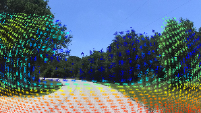
- A novel Rural Road Detection dataset (R2D2) was prepared and released. The dataset contains time-synchronized and annotated data from sensors such as High Resolution LIDAR, Stereo Cameras, GPS and IMU.
- Object Detection models such as YOLOv5 and Point Cloud segmentation models such as RangeNet++ were trained on the data from R2D2.
Final Report
EWD & T2 Products
Ninan, S. (2023). Perception and Localization for Rural Roads. (Masters Thesis).
Stephen Ninan, a Master’s student in the Department of Mechanical Engineering at Texas A&M University, was funded through this project. His student impact statement is here.
Ninan, Stephen & Rathinam, Sivakumar, (2023), Technology to Ensure Equitable Access to Automated Vehicles for Rural Areas (06-004), https://doi.org/10.15787/VTT1/ZGRYVU, VTTI, V1
Ninan, Stephen & Rathinam, Sivakumar, 2022, Autonomous Vehicle Rural Road Dataset (06-004), https://doi.org/10.15787/VTT1/AOHI5N, VTTI, V1
Ninan, S. (2022). A ROS package for GPS denied localization using Open Street Maps. GitHub repository, https://github.com/nsteve2407/osm-localization.
Presentations/Publications
Ninan, S., Rathinam, S., Mittal, H., & Sunny, B. (2023). R2D2: Rural Road Detection Dataset. IEEE International Conference on Intelligent Transportation Systems.
Ninan, S., & Rathinam, S. (2022). LIDAR data based Segmentation and Localization using OpenStreet Maps for Rural Roads. Arxiv. Available here.
Ninan, S. (July 2022).Technology to Ensure equitable access to Autonomous Vehicles for Rural Areas. Transportation Research Board’s, Automated Road Transportation Symposium (ART’s) 2022. Presentation available here.
Ninan, S. (April 2021). GPS denied localization using Open Street Maps. Seminar to industry participants from Rivian Motors Pvt. Ltd.
Final Dataset
The final datasets for this project are located in the Safe-D Collection on the VTTI Dataverse; DOI: 10.15787/VTT1/ZGRYVU.
Research Investigators (PI*)
Sivakumar Rathinam (TAMU/TTI)*
Stephen Ninan (TAMU/TTI-Student)
Project Information
Start Date: 2021-09-01
End Date: 2023-08-31
Status: Complete
Grant Number: 69A3551747115
Total Funding: $240,371
Source Organization: Safe-D National UTC
Project Number: 06-004
Safe-D Theme Areas
Big Data Analytics
Automated Vehicles
Safe-D Application Areas
Vulnerable Users
Operations and Design
Vehicle Technology
More Information
RiP URL
UTC Project Information Form
Sponsor Organization
Office of the Assistant Secretary for Research and Technology
University Transportation Centers Program
Department of Transportation
Washington, DC 20590 United States
Performing Organization
Texas A&M University
Texas A&M Transportation Institute
3135 TAMU
College Station, Texas 77843-3135
USA